Learn Geography Online
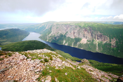
The mountainous landscape which rise sharply from the lowland delta to an elevation ranging from fourteen hundred to thirty six hundred feet consist mainly of rock. This rock is mostly barren of trees. The rock is thinly covered by drift, colluvium and vegetation. Many hills, steep slopes and mountains are crisscrossed with rock valleys and troughs. Many cirques encircle the English Mountains (eastern section of Mealy).
The next major landscape to consider is the plateau. This is located south of the Mealy Mountains range with an elevation ranging from fourteen hundred to sixteen hundred feet It differs from the mountain topography being below the tree line. This area unlike the mountains has no series of crisscrossed rock valley, instead it features mostly basal till veneering rock with occasional areas of partially organic terrain. The plateau area just south of the Mealy Range is covered with drumlins. Many of these drumlins have their crags (blunt non tapered part of a drumlin) facing south and tails facing north indicating that the ice flow was to the north (the retreat of Lauren-tide). The soil of the plateau is more organic than the mountains. The soil consists mainly of basal till veneering rock.
The south east, south central and east central areas of the map are the uplands. They are characterized in contrast with the plateau by being slightly lower in elevation (around fourteen hundred to one thousand feet) and much more organic. Over seventy percent of this landscape is covered by areas consisting of fifteen to fifty percent or over of organic terrain. This is mostly in the form of basal till. The basal till is often gently rolling and is sometimes preferred to as ground moraine.
There are many eskers in these upland and they generally point in a north eastern direction. Eskers are a main type of land-form that results from glacial melt water deposition. This deposition generally shows a close correspondence to the latest glacial ice movement in the region.
A large end moraine just east of the English Mountains indicates the beginning of the regions northern limits. In the north east corner of the map lies the coastal mid latitude area, which drops off in elevation relative to the uplands. The elevation is one thousand to two hundred feet. This mid latitude coast area differs from the uplands by containing more veneering rock, less organic soil and fewer eskers. There is however an increase in drumlins which change their alignment (as opposed to a plateau area) to north-west south-east.
Across Lake Melville the western portion of the peninsula separating the main lake from the Coley arm is similar to the lowland areas around Epinette Peninsula. This Mulligan Bay area consists mostly of fine grained marine deposits with many abandoned beach ridges. The fine soil built up new beaches further out into the inlet. A few miles into the interior of the Peninsula in Mulligan Hills region, the elevation rises to approximately a thousand feet. The ground of basil till indicates glacial activity and not just sediment deposits. Many drumlins are present with their crags facing east. In the plateau area the crags face south and in the mid latitudes they face south-east. It is theorized the northward flowing ice came across the narrow separating the back way from Lake Melville and then flowed westward, north of Lake Melville. This theory however is unclear. Some Geo-morphologists believe that drumlins are formed at the time of ice advance but this is open to debate, as they could be formed in times of retreat as well.
Lake Melville’s north shore becomes less organic and more comprised of basal till veneering rock as one moves eastward The highlands which contain a mountain of 1575 feet elevation contain a mixture of basil till and veneering rock. The veneering rock becomes more prominent as one moves westward.